
Locate Town of Ithaca Neighbors
Public records around a Town of Ithaca address provide different forms of block evidence. A map can show touching parcels. Assessment can provide a dated property relation if a card is available. Town permit records identify a project at an address. A printed directory line establishes only a past entry. The useful question is not simply who the neighbors are, but what each source can actually support about the selected block.
| Source | What it shows about a block | Access |
|---|---|---|
| County GIS parcel layer | Adjacent polygons, parcel IDs, geometry, and documented assessment, school, election, NRI, and FEMA layers. | Public map service; current user interface and sample-result details remain a gap. |
| County Address Lookup | Official address, ZIP, and municipality for a selected address. | County mapping route; exact current widget controls were not captured. |
| County Assessment | Dated owner, mailing, and situs relation if the parcel card is available. | Beacon or Assessment office; live Beacon field details were not inspected. |
| Town OpenGov | Address-keyed permits, projects, and selected certificates or documents. | Public Locations and Records tabs; older documents often have a pre-2022 gap. |
| Historical street section | Sequential printed person, business, institution, household-mark, or vacancy lines. | Tompkins County Public Library PDFs, microfilm, catalog, and local-history staff. |
| Voter record route | Limited individual registration evidence or a lawful list request with specified geography. | NYS Voter Lookup and Tompkins Board of Elections, subject to purpose limits. |
A block cannot be inferred from a same ZIP. Parcel geometry, road frontage, cross streets, and the Town or City boundary define a much more defensible search area for Town of Ithaca neighbors.
Define Town of Ithaca Neighbor Blocks
For this purpose, state whether the block means the same parcel, touching parcels, one street segment between cross streets, a historical directory sequence, or a map radius. These are not interchangeable. A parcel can contain several buildings. A building can have several units. A street can cross the Town and City line. A ZIP, school district, polling district, and planning area can each draw a different map of “nearby.”
The Town's 14850 postal warning is especially important. The same Ithaca mailing label can point to more than one municipality. Use the Town address verifier, retain the official municipality result, and repeat the check for each selected property. The Town's form-based neighborhood code names planning locations such as East Hill Plaza, the Danby/King intersection, and West Hill, but those are planning categories rather than membership lists.
Map Town of Ithaca Neighbor Parcels
County GIS is the starting point for mapping Town of Ithaca neighbors. It is not a prebuilt neighbor list. The documented workflow is a careful sequence: subject address → GIS parcel → adjacent parcels → owner or mailing labels → carefully dated historical or voter context. The County mapping material confirms that the Simple Parcel Viewer accepts an address or Printkey and that Address Lookup can return ZIP, municipality, and official address.
- Verify the raw address in the Town tool and record the Town or City result, street frontage, and cross streets.
- Search the County GIS parcel service by address or Printkey and retain the subject polygon and parcel ID.
- Browse the touching or immediately surrounding parcel polygons, recording each ID as a separate record rather than combining them.
- Open each parcel's assessment or recorded-land route independently, keeping owner, mailing, situs, and document dates as distinct labels.
- Add a dated street-directory or lawful voter clue only after the parcel and municipal checks are complete.
The research did not verify a current Town neighbor-buffer tool, a buffer distance, current adjacent-parcel control, municipality filter, export, or print behavior. A City historic map example uses a 200-foot buffer, but that is not a Town rule or a current Town GIS guarantee. Describe the method as map browsing and independent verification, not as a radius result.
The County GIS public parcel service provides the map-to-parcel route for block context.
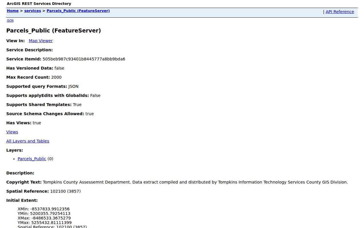
The image documents the parcel-service path. It does not verify a Town block result, a current buffer mechanic, or the identity of every person connected with a parcel.
Interpret Town of Ithaca Neighbor Records
A parcel record may show a situs, a dated owner, and a separate mailing address. Those are useful labels, but they do not prove that the owner is the current person at the property. Trusts, estates, companies, banks, and mailing services can appear in a property trail. A parcel may also be institutional, commercial, multi-building, or divided into several units. Keep the relationship exactly as the source presents it.
Tompkins County Assessment Beacon is intended to expose ownership, assessment values, details, sketches, and tax maps. During research, the live Beacon form returned HTTP 402, so no Town card or field order was inspected. The County Assessment route and the office at 607-274-5517 are the accurate fallback. For a recorded transfer, use the County Clerk index and compare the legal description with the parcel rather than relying on a map label.
Note: The County's older metadata describes parcel keys in an SSBL-style format, but it dates from 2008 and should not be used to reconstruct a current Printkey.
Keep Town of Ithaca Neighbor Voter Context
The individual NYS Voter Lookup asks for County, last name, first name, date of birth, and ZIP. It is for registered-voter lookup, poll-site information, and mail-ballot tracking. It does not provide a public click-through roster for everyone on a Town of Ithaca block, and a no-match does not prove a person is absent from an address.
Tompkins County Board of Elections maintains the broader voter-file request route. Its form can ask for list type, labels, party, Town, ward, district, delivery format, stated purpose, signature, and payment. Election Law §3-103(5) limits that use to election purposes, and knowing violation can be a misdemeanor under §17-168. Protected voters and Address Confidentiality Program participants must not be reconstructed. The BOE's August 2026 move to 214 W State Street means an older form may not carry the current office address.
Compare Town of Ithaca Neighbor Sources
Official records and commercial neighbor-search tools are not interchangeable. The official side names its custodian, date, scope, and request route. A commercial category may combine old sources or add a paywall, but it does not make a map label current or turn an owner relation into a household list. Use the official path when the question calls for a narrow, verifiable record.
| Official Town or County route | Commercial neighbor-search category |
|---|---|
| Provides a parcel, address, instrument, permit, or voter process with an identified custodian and stated limits. | May aggregate mixed-date material, but the underlying source, update date, and correction path may be unclear. |
| Supports a focused request to GIS, Assessment, the County Clerk, Town Code Enforcement, or the Board of Elections. | Cannot replace a custodian's record or prove every person connected to a parcel. |
| Lets the reader preserve municipal boundary and record-date context. | Can blur a postal label, historical address, or mailing relation into an overbroad claim. |
Read Town of Ithaca Neighbor Civic History
No current official Town-wide civic-association directory was located. The available local list is a historical City of Ithaca inventory in the 2003 Public Art Plan. It is useful for locating a dated community name in a historical search, but it does not establish current membership, current contact information, Town coverage, or an organization boundary. Treat it as history, not as a directory of Town of Ithaca neighbors.
| 2003 City historic inventory examples | How to use the name now |
|---|---|
| Bryant Park Civic Association; Center Street Neighborhood Watch; Collegetown Neighborhood Association | Historical City civic references only; no current Town membership list was located. |
| Cornell Heights Civic Association; CAN-DO; East Spencer Street; First Street | Check the dated 2003 City Public Art Plan, then verify present status independently. |
| Hector Street; Henry St. John; Northside Neighborhood Planning; Orchard Place; We Are Neighbors Too | Do not infer that the group currently exists, covers the Town, or maintains a roster. |
Use Town of Ithaca Neighbor History
The street-section method can give a block a date. Tompkins County Public Library's 1951 business and street material and 1960 street directory show address-to-name, business, household notation, and vacancy lines. Read the target number in sequence, then compare nearby lines, cross streets, the alphabetic section, and the next available year. A printed line is evidence for that volume, not proof that a person stayed there.
The 1960 street directory is the local reverse-search example. Sanborn maps can add footprint and lot context. Search Floral Avenue as Humboldt Street and the short-lived Enfield Road, and search Giles Street as Creek Road when a modern string fails. These aliases, cross streets, and lot shape are stronger continuity clues than a same-ZIP match.
Respect Town of Ithaca Neighbor Boundaries
The Town wraps around the City in a horseshoe geography. A City label, City neighborhood plan, or City park name should not be carried into a Town record without verification. County GIS can identify the municipal context, but parcel-specific permit and zoning questions belong with the correct local government. When a block crosses a Town or City line, label the crossing and route each property to its own custodian.
Myth: a shared postal line means the same neighborhood or government. The Town address verifier, County parcel geometry, legal municipality, planning category, and historical street sequence can all be different layers. Town of Ithaca neighbors research stays more accurate when those layers are not merged.
Protect Town of Ithaca Neighbors
Neighbor records should be used for limited personal, family-history, property, or civic questions, never to track someone. Public parcel geometry does not reveal every household member. Non-owner occupants, protected voters, Address Confidentiality Program participants, utility customers, delivery records, DMV addresses, sealed court parties, and people without a public role in a parcel record stay private or uncertain. A historic group name is not permission to publish a present roster.
Lawful use. Use Town of Ithaca neighbor sources with care and respect for privacy. Do not use any address, map, voter, or historical record to watch, stalk, harass, intimidate, or harm a person.